Elapsed
Time 12 hours
Riding
Time 9 hours 15 minutes
446 Miles
48.3 mph
Beemer Stats:
459 miles
49 mph
48 mpg
 |
| The Day Final Cleared |
Our intrepid tour master and navigator had some vacation downtime at OBX which he spent poring over maps to find a better way to get to the roads of West Virginia. Our plan was to form up at 7:00 am at the Lowes in Shillington and slab through the early morning light to breakfast at Fay's in Carlisle, then launch from there on the blue highways through southern Pennsylvania and the western Maryland panhandle into West Virginia, landing for the night at Richwood. This would be a relatively long day, 400+ miles, requiring the early start to make it in by dark at this time of year.
The radar showed rain over Reading with another band of rain between Reading and Harrisburg, then basically clear sailing to the west and south. Heading up 422 at 6:30 in the dark and rain with limited visibility was pretty miserable riding, basically trying to avoid any hazards while following the stream of red tail lights which was about all that could be seen. By form up, the sky was starting to lighten, and the run west on 222 and the turnpike was not as bad; at least there was some light, though we did hit that other band of rain, as promised. By the time we left the turnpike at Carlisle we had pretty much left the rain behind but the roads were still wet and the sky was overcast. Even with the rain, the early start got us to Fay's before 8:30, basically an hour and 10 minutes from Lowes to breakfast.
 |
| Slow Turtle in the Road |
 |
| Oldtown Bridge Over the Potomac |
 |
| Crossing Oldtown Bridge |
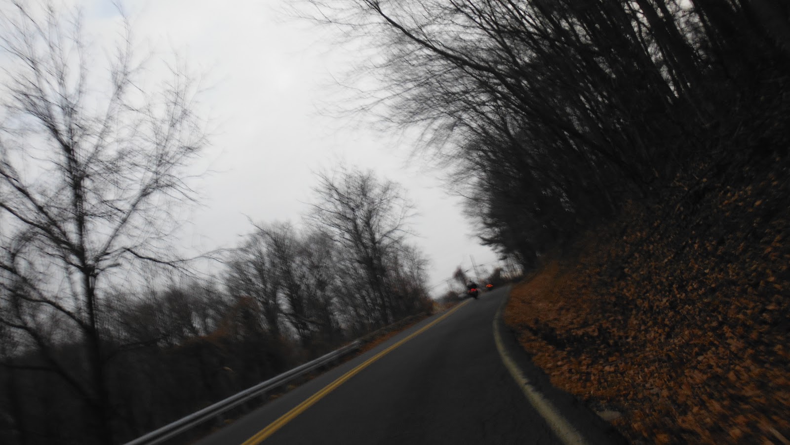
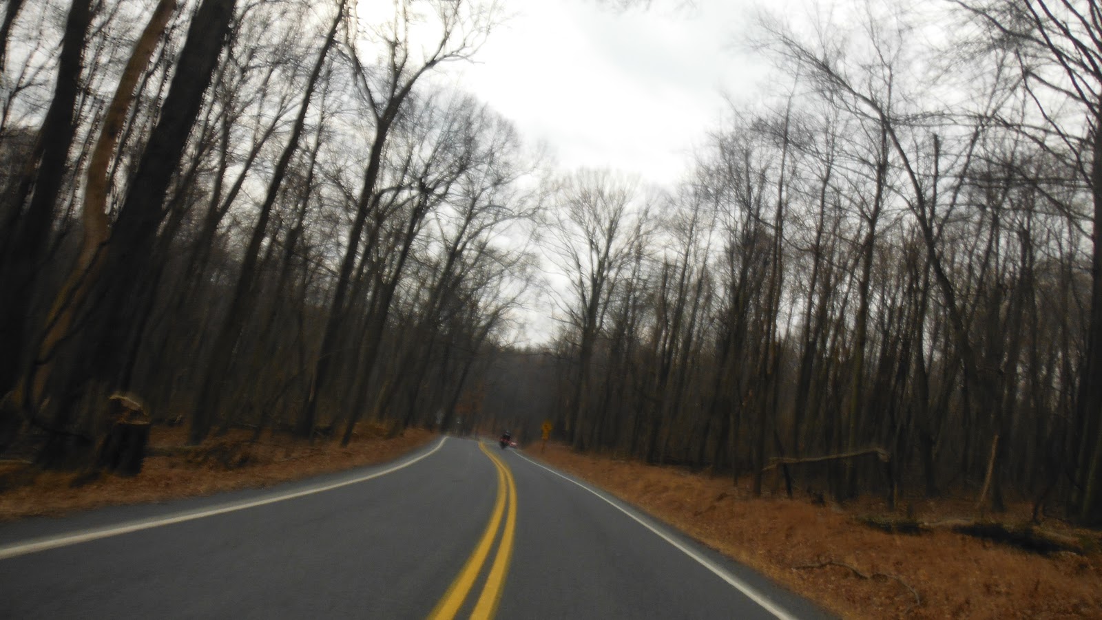
Breakfast at Fay's never disappoints and it's hard to get out in under an hour and half. Today, rushing, we managed it in an hour and 15. The plan was to hit the blue highways from this point on. It was still overcast as we headed across the Great Valley on Rt 641 out of Carlisle. Riding across the Great Valley is usually not very exciting - it's relatively flat with generally straight roads and is mostly settlements and farms often with local traffic moving at a stodgy pace. This morning was not so bad, traffic-wise, and we soon found ourselves heading up into a cloud covered first ridge of the Valley and Ridge Province on Upper Strasburg Road. At this point, the roads improved but visibility degraded significantly due to heavy fog and condensation on face shield - slow going for a while but at least rising out of the civilized lowlands into more exciting motorcycle country.
Towards the end of the morning, the sky started to clear and we found ourselves twisting south through the V&R of southern Pennsylvania, at some point crossing into the Maryland panhandle, with dry roads and clear weather by our gas stop at Flintstone, Maryland. At this point, we had been following the route of the old National Road west across the mountains, paralleling I 68.
 |
| Oldtown Lock on the C&O Canal |
We took the opportunity to dip down, cross the C&O Canal at Oldtown locks, then cross the Potomac on the one lane, wooden, low-water bridge between Oldtown and Green Springs, WV. We've seen this bridge before in the blog, but it's always an adventure to use it again. Approaching the bridge, between the canal and the river, we swerved around a slow turtle crossing the road and stopped for some photos.
The afternoon was a run south through the West Virginia V&R under clear skies and nearly perfect temperature in the 60's. A little after 5:00, we turned up the Appalachian Front escarpment at Cass and into the hill and hollow country of the eroded plateau, finally landing, tired, at Richwood around 6:30 with around 450 miles on the clock.
 |
| Seneca Rocks |
Dinner was at Mummsey's, a 2 miles ride into town in the dark, surprisingly good considering, and glad to get it as they were closing soon and there weren't really any other options in the vicinity.
Day 2, October 20, 2012 - Bridge Day
 |
| Day 2 Route |
Gypsy Stats:
Elapsed
Time 9 hours 53 minutes
Riding
time 5 hours 33 minutes
250.6 Miles
45.2 mph
Beemer Stats:
264.6 miles
48 mph
48 mpg
 Normally, we wouldn't require a reason or destination to ride motorcycles around West Virginia on a beautiful autumn day, but today we had one: Bridge Day. The New River Bridge, carrying US 19 across the New River Gorge, just downriver from the confluence of the New and Gauley Rivers near the town of Gauley Bridge is the longest arch bridge in the Western Hemisphere, carrying the highway 990+ feet above the river in the gorge below. One day a year, they close the bridge so a bunch of nutters can climb up an additional 10 feet from the top of the bridge to a diving board and jump off. Insane. They do this wearing base-jumping para-foils and they act like they do it for fun, but still, insane.
 Bridge Day is a bike-friendly event, and being held on the third Saturday of October during the peak of the autumn color season it tends to attract a lot of riders. Breakfast was at the Richwood Moose Lodge ("...you don't need to be a member..."), mostly full of other bikers fueling up for the ride over to Gauley Bridge and the spectacle. The old coot taking our order told us "you can't sit down" when we asked him about the sausage gravy and biscuits. We really were not sure what this meant exactly; it's subject to several interpretations, some not particularly savory. But Tim and I were both game and gave it a try. I still don't know what "you can't sit down" means, but I do know that this was some of the best sausage gravy and biscuits I have ever had, a definite come-backer. So if you are ever in Richwood, WV, for breakfast, try the Moose Lodge; after all, you don't need to be a member.
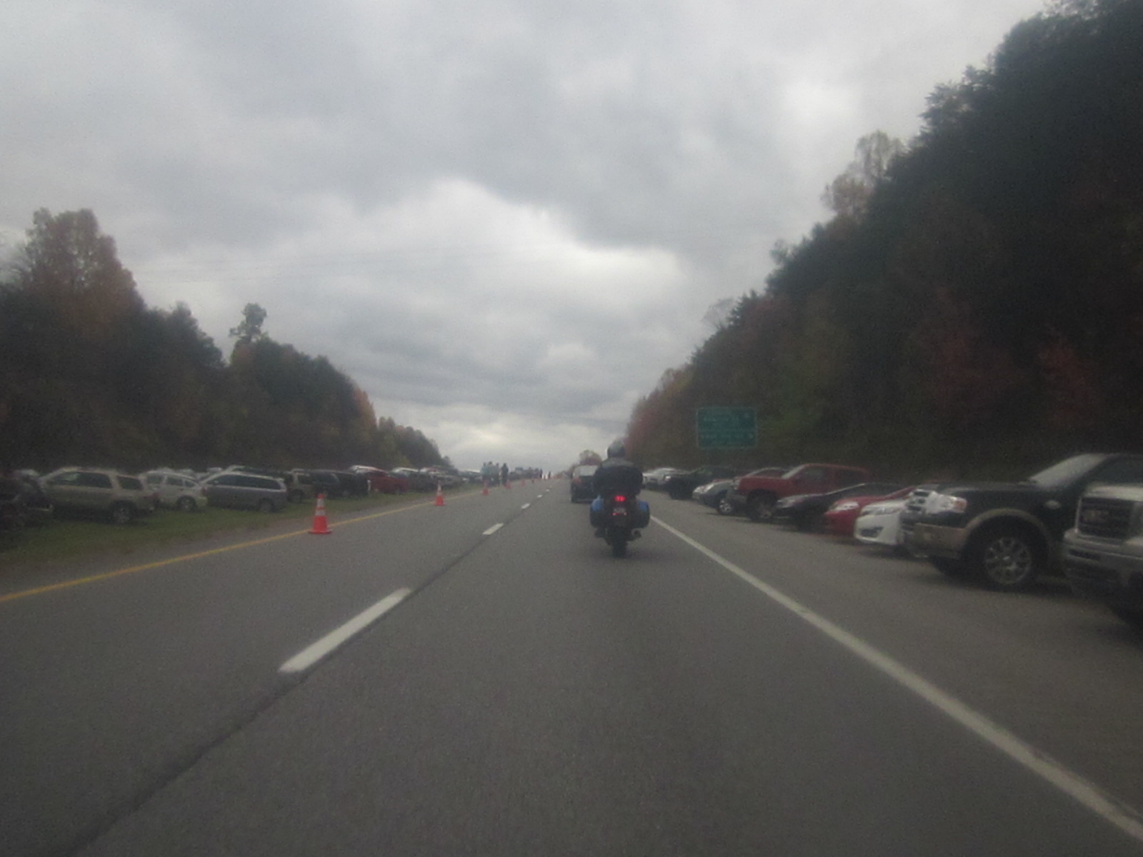
 The day was gray with a high overcast and temperatures in the 50's. Autumn colors in West Virginia were maybe 3-4 days past peak, somewhat subdued this year, but still pretty glorious riding conditions. An hour and half ride through the West Virginia hills brought us to Rt 19 and the New River Bridge. Signs on the highway announced "Road Closed - Bridge Day" and they weren't kidding. About two miles before the bridge there was a state police blockade closing the road. By this point the sides of the highway were full of parked cars and people were walking down the highway towards the bridge. From the blockade on, the rule appeared to be people and shuttle buses in the northbound lanes, emergency vehicles in the southbound lanes. A friendly state trooper at the blockade told us to cross over and ride down the pedestrian lane to the motorcycle parking area; definitely bike-friendly. Bikes parked, we were soon heading afoot with the crowd down the middle of the thruway towards the bridge.
 |
| The Highway was Closed and Cars Parked |
 |
| Bike Parking by the Pedestrian Walkway |
Bridge Day is a happening. They say 1/4 million people show up to watch the nutters jump and enjoy the festival it has become. The highway on either end of the bridge has spawned a midway with food vendors stretching for about a mile. In addition to the jumpers, there is a 1000 foot long zip line from the bottom of the bridge to the gorge below which you can ride down (I assume for a fee). Shuttle buses ferry people from the bridge to the gorge and back, bringing back the jumpers who repack their 'chutes in the median strip and line up for another jump. There is a target (looks small from here) on the bank of the river; the object is to land as close to the target as possible but overshooting puts you in the trees and undershooting plops you in the river. Four boats stand by in the river to pick up dunked jumpers.
We walked the midway from end-to-end and back, stopping on the bridge to watch the jumpers float down to the bank (or into the water). It's quite a circus and worth having seen, but after 2 1/2 hours we were ready to get back to our primary purpose, so back to the bikes and our weekend ride.
 |
| Road Packed with People Approaching Bridge |
 |
| New River Gorge |
 |
| Riding the 1000 Foot Zip Line |
 |
| Para-foils in the Gorge |
 |
| Jumpers Lined Up on the Board |
 |
| Rt 16 - Recommended End-to-End |
We headed west on Rt 60 and caught Rt 16 north. Last time down, Doc had recommended Rt 16 as a great ride end-to-end and we were not disappointed with this stretch. From Rt 16, Rt 33 east to 5 east and a jog over Rt 19 brings us to Rt 20, our route south to Webster Springs, landing point for the night. These are all great roads and we were riding under near perfect conditions: dry pavement, moderate temperatures, even lighting. It's hard to imagine it any better than this. Rt 20 was one of our favorites last rip and it lends a perfect end to the day's ride.
 |
| After 2 Days of WV Roads |
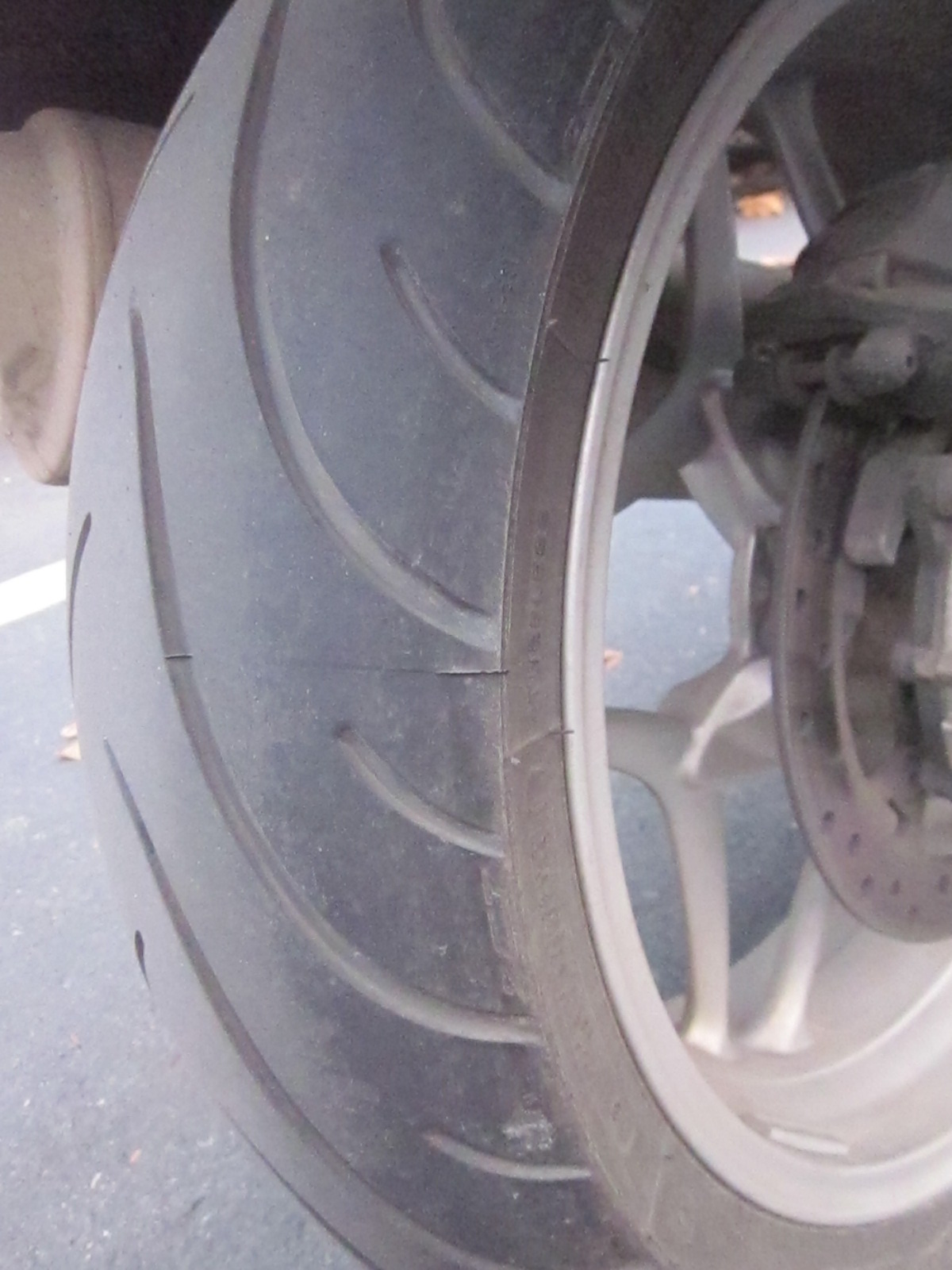
I am running my new Michelin Pilot Road 2 tires which are amazingly stable. We've been running a little hotter than usual this trip, just high spirits and good roads, I guess, and by the end of our second day of West Virginia roads, the "chicken strips" on the new rear are nearly gone.
The Mineral Springs motel in Webster Springs is another come-backer: huge, comfortable room for a reasonable price, restaurant across the lot within walking distance, no bad roads between it and the outside world... Short day today with the long break for Bridge Day but not a bad road to be found and near perfect riding.
Day 3, October 21, 2012
 |
| Day 3 Route |
Gypsy Stats:
Elapsed
Time 10 hours 11 minutes
Riding
time 7 hours 52 minutes
396.8 Miles
51.6 mph
Beemer Stats:
409.6 miles
53 mph
49 mpg
Hacker Valley, home of Rella's Diner, of which we had heard on our May visit, was just north of Webster Springs on Rt 20, but the man at the hotel said that "sometimes she doesn't get up early on Sunday morning" but that there was breakfast at Holly River State Park just north of there. Sure enough when we stopped at Rella's at 8:30, the sign advertised opening Sunday at 8:00 but there was no sign of life. We moved on the Holly River and breakfast at the State Park restaurant.
 |
| Holly River State Park |
 |
| Rt 50 Detail |
Fully fed, it was time to start the trek home, so north on Rt 20 to Rt 119, across twists and turns up the plateau to Rt 50. Rt 50 east is an old favorite and does not disappoint this morning. The sun is out, temperatures are in the mid-60's, autumn colors are bright, and traffic is light. There are few roads that can top our new old favorite, Rt 99, but this stretch of Rt 50 features a serpentine of 20 curves in a row without let up. And before some dickweed with a petermeter says the words "Deal's Gap" let me remind you that this was not a destination road, it was our route home instead of fighting our way through the trucks on I 81 up the Shenandoah Valley.
 |
| Heading Towards Sidering Hill |
We headed across the plateau on Rt 135. As we head north, the landscape changes from the eroded hill-and-hollow, left-side of West Virginia to the flat plateau, like the Poconos, that we are used to in Pennsylvania. On 135 we start the steep decent down the front into the gap cut by the North Fork of the Potomac River. For a great deal of its length, the Eastern Continental Divide follows the ridge of the Appalachian Front escarpment very closely. The North Fork of the Potomac is the exception, cutting a gap through the ridge much as the rivers of Pennsylvania cut through the ridges of the V&R. The run down into the North Potomac gap in the sunshine is much pleasanter than last May when we followed the same route in a driving rain with near zero visibility.
 |
| Into the Pennsylvania Valley and Ridge Province |
We continue north and east through the V&R, stopping for gas again in Flintstone before following the National Road back east, riding up over Sidering Hill and into Pennsylvania. We wind up on the old Lincoln Highway, Rt 30, crossing Tuscarora Mountain, following a truck at 10 mph down the last ridge into the Great Valley. It's a grueling 1/2 hour across the valley to I 81 at Chambersburg. We would have done better to head north to the turnpike as soon as we were approaching the valley - crossing the valley, you might as well slab it as much as possible, time saved and not much lost in riding pleasure.
From Chambersburg, up I 81 to the turnpike and home by 6:15 in daylight with 400 miles on.
So what did we learn?
1. Focus on the journey, not the destination. In September, we took 3 days, trailered down the highway 500 miles each way, and got basically one day of good riding on excellent roads. In October, we took 3 days, rode 400 miles each way mostly through the V&R on some really good roads. If we subtract the 250 miles of slabbing across the valley to reach the V&R, we got in 850 miles of great riding. If we had ridden all day Saturday instead of stopping for Bridge Day, it could have been more.
2. For crossing the Great Valley, you might as well slab the whole way; it gets you to the good roads sooner with less hassle and gets you home sooner with little loss of fun riding.
 Gypsy Stats:
 Fourth Sunday: not much firehouse breakfast action and the VFW was closed 'cause of Christmas. We were looking for something not too far so that while we were sitting and jawing the sun could be rising and warming: Marvel Ranch in downtown Reading - perfect - don't leave the tank bag or helmet on the bike, remember to take the key and carry the Gypsy in with you, and as long as you're packing the heat (Gerbing, that is), don't mind the other customers who are packing the heat (not Gerbing, that is). The coffee was excellent, better than any firehouse. Tim and Dave ordered the house special, the Marvel Mess - scrambled eggs with some of nearly everything you might imagine to put in eggs. I got two, over-medium, with pork chops, home fries, and dry rye toast. It was awesome! And the coffee kept flowing, and we kept BS'ing, and there were still some open tables so they didn't need to kick us out, and the waitress was nice, and the bill came to $22 for the three of us. What's not to like? Oh, yeah, did I mention how polite they were? The sign in back read "No Getting High in the Rest Room, Please" (emphasis mine).